


BRIDGETON TWP Voting District, Bucks County, Pennsylvania
About
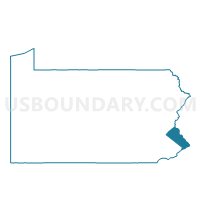
Outline

Summary
| Unique Area Identifier | 657630 |
| Name | BRIDGETON TWP Voting District |
| County | Bucks County |
| State | Pennsylvania |
| Area (square miles) | 6.80 |
| Land Area (square miles) | 6.58 |
| Water Area (square miles) | 0.22 |
| % of Land Area | 96.76 |
| % of Water Area | 3.24 |
| Latitude of the Internal Point | 40.55284240 |
| Longtitude of the Internal Point | -75.12172320 |
Maps


Graphs
Select a template below for downloading or customizing gragh for BRIDGETON TWP Voting District, Bucks County, Pennsylvania


Neighbors
Neighoring Voting District (by Name) Neighboring Voting District on the Map
- Alexandria township voting district 1, Hunterdon County, NJ
- Holland township voting district 4, Hunterdon County, NJ
- Holland township voting district 5, Hunterdon County, NJ
- Milford borough voting district 1, Hunterdon County, NJ
- NOCKAMIXON TWP VTD NOCKAMIXON, Bucks County, PA
- NOCKAMIXON TWP VTD REVERE, Bucks County, PA
- TINICUM TWP VTD DELAWARE, Bucks County, PA
Top 10 Neighboring County Subdivision (by Population) Neighboring County Subdivision on the Map
- Holland township, Hunterdon County, NJ (5,291)
- Alexandria township, Hunterdon County, NJ (4,938)
- Tinicum township, Bucks County, PA (3,995)
- Nockamixon township, Bucks County, PA (3,441)
- Bridgeton township, Bucks County, PA (1,277)
- Milford borough, Hunterdon County, NJ (1,233)
Top 10 Neighboring Place (by Population) Neighboring Place on the Map
Top 10 Neighboring Elementary School District (by Population) Neighboring Elementary School District on the Map
- Holland Township School District, NJ (5,291)
- Alexandria Township School District, NJ (4,938)
- Milford Borough School District, NJ (1,233)
Top 10 Neighboring Secondary School District (by Population) Neighboring Secondary School District on the Map
Top 10 Neighboring Unified School District (by Population) Neighboring Unified School District on the Map
Top 10 Neighboring State Legislative District Lower Chamber (by Population) Neighboring State Legislative District Lower Chamber on the Map
Top 10 Neighboring State Legislative District Upper Chamber (by Population) Neighboring State Legislative District Upper Chamber on the Map
- State Senate District 24, PA (278,648)
- State Senate District 10, PA (259,178)
- State Senate District 23, NJ (229,972)
Top 10 Neighboring 111th Congressional District (by Population) Neighboring 111th Congressional District on the Map
Top 10 Neighboring Census Tract (by Population) Neighboring Census Tract on the Map
- Census Tract 106, Hunterdon County, NJ (6,171)
- Census Tract 105, Hunterdon County, NJ (5,291)
- Census Tract 1039, Bucks County, PA (3,995)
- Census Tract 1037, Bucks County, PA (3,441)
- Census Tract 1038, Bucks County, PA (1,277)